Levy County, Florida

part of USGenWeb Project and FLGenWeb project
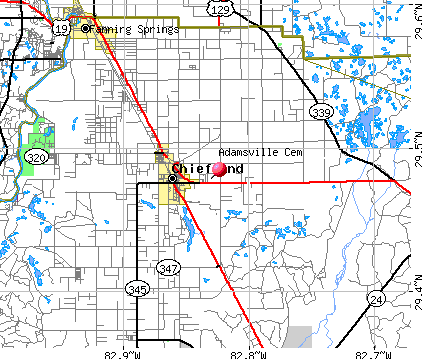
 

Home ] Car Registrations 1913 ] Cemeteries ] Census ] Churches ] Disease of Old ] Death Index ] Delayed Birth ] Land Patents ] Mark and Brand registered ] Marriages of Levy County (Surnames) ] Military ] Social Security Index ]

Name Index • Adjacent Counties Cem. • Adamsville • Antioch • Asbell • Atsena Otie • Barber Family Cem. • Bishop Point • Bronson • Old Bronson Cem. • Cannon • Carter • Cedar Key • Cedar of Lebanon • Chiefland • Chiefland Community • Church of Christ • Dog-ear or Black Dirt • Duncan Family Cemetery • Ebenezer • Ellzey • Galilee • Hardee • Hawthorne or Prim. Church of Jesus Christ Cem. • Hearn • Hodges • Inglis • Joppa • King • Kirkland • Levyville • Levyville - New Zion • Long Pond • Melton, Jim • Montbrook • Morriston • Mt Erie • Mt. Olive • Mt. Pleasant • New Hope • New Zion (Chiefland) • Orange Hill • Pine Grove • Pleasent Hill • Plummers • Priest • Robinson • Rocky Hammock • Rosemary • Sand Pond • Scott Cemetery • Seahorse Key Cem. • Shady Grove • Shiloh • Sistrunk Cemetery • Smith • St. Josephs • Wacahoota • Wacahoota Bap • Wekiva • Willis, George Washington

Home
Up

Adamsville Cemetery

Town Latitude Longitude
Chiefland 29.478°N 82.830°W
Range Township Secton
15E 11S 32
mapadamsvillecem.bmp (152398 bytes)


this page was last updated on: 08/30/10 08:12 PM


If you have comments or suggestions, contact the volunteer host, Tom Parker

All featured documentation displayed on this site belong to the named submitter.  They have provided the documentation for the personal benefit of all individuals who want to know more about their families past.   For more information on this please view the Declaration Page.

Copyright © 2008, 2009, 2010 - All rights reserved.